search
Italy sea map
Map of Italy sea. Italy sea map (Southern Europe - Europe) to print. Italy sea map (Southern Europe - Europe) to download. Four seas surround the Italian peninsula as its shown in Italy sea map: the Adriatic, Ionian, Ligurian, and Tyrrhenian Seas. There is almost no spot in Italy that lies farther than 120 kilometers (75 miles) from a coastline. At its deepest point, the Ionian Sea reaches a depth of 4.4 kilometers (2.75 miles), the greatest depth recorded in Mediterranean waters.
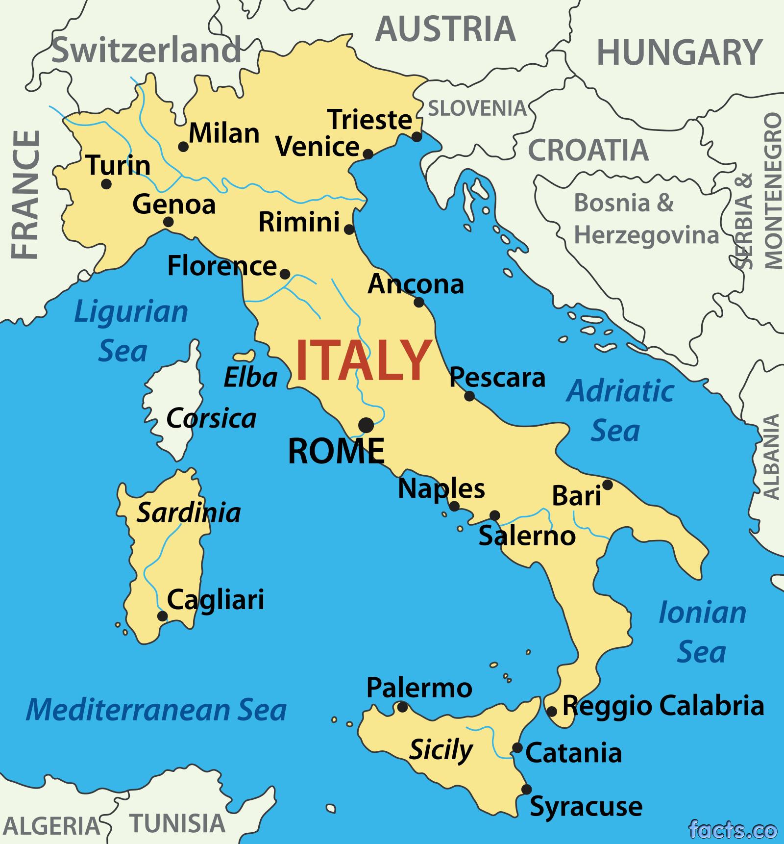
There are 7,600 km (4, 720 miles) of coastline in Italy. At the northern end of the Adriatic Sea is the Gulf of Venice; to the south the Strait of Otranto connects it with the Ionian Sea as its mentioned in Italy sea map. The large Gulf of Taranto in the Ionian Sea is located between the "toe" and "heel" of the Italian "boot." The narrow, funnel-shaped Strait of Messina connects the Ionian and Tyrrhenian Seas, separating Sicily from the Calabria region, at the tip of the Italian peninsula. The Malta Channel separates Sicily from Malta, and the Sicilian Channel lies between Sicily and the Tunisian coast.