search
Italy topographic map
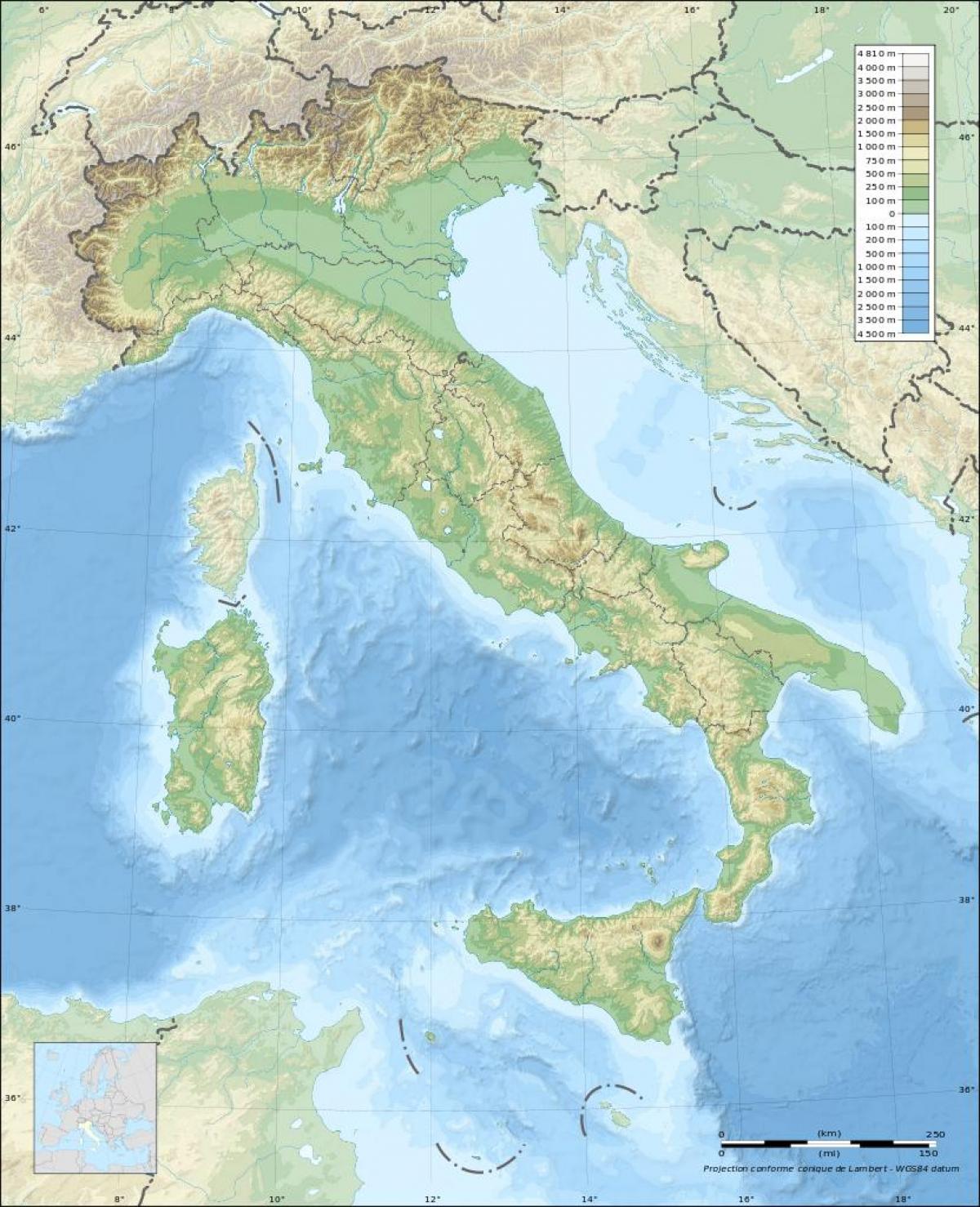
Map of itlay topographic. Italy topographic map (Southern Europe - Europe) to print. Italy topographic map (Southern Europe - Europe) to download. Except for the fertile Po River Valley in the north and the narrow coastal belts farther south, Italy mainland is generally mountainous, with considerable seismic activity. During Roman times, the city of Pompeii, near present-day Naples (Napoli), was devastated first by an earthquake in AD 63 and then by the famed eruption of Mt. Vesuvius (1,277 m/4,190 ft) in AD 79 as its shown in Italy topographic map. In the last century, an earthquake in northeastern Italy on 6 May 1976 left more than 900 people dead, and a quake in the south on 23 November 1980 (and subsequent aftershocks) claimed at least 4,500 lives.
The altitudes are lower in southern Italy, the Calabrian coast is still rugged. Among the narrow, fertile coastal plains, the Plain of Foggia in northern Apulia, which starts along the Adriatic, and the more extensive lowland areas near Naples, Rome, and Livorno (Leghorn) are the most important. The mountainous western coastline forms natural harbors at Naples, Livorno, La Spezia, Genoa (Genova), and Savona, and the low Adriatic coast permits natural ports at Venice (Venezia), Bari, Brindisi, and Taranto. Mount Etna (3,369 m/11,053 ft) is an isolated and active volcano in the northeast. Sardinia, in the Tyrrhenian Sea, is generally mountainous and culminates in the peak of Gennargentu (1,834 m/6,017 ft) as its mentioned in Italy topographic map. The largest and most fertile plains are the Campidano in the south and the Ozieri in the north. The principal bay is Porto Torres in the Gulf of Asinara.
The Alpine mountain area in the north along the French and Swiss borders includes three famous lakes—Como, Maggiore, and Garda—and gives rise to six small rivers that flow southward into the Po. Italy highest peaks are found in the northwest in the Savoy Alps, the Pennines, and the Graian chain. They include Mont Blanc (4,807 m/15,771 ft), on the French border; Monte Rosa (Dufourspitze, 4,634 m/15,203 ft) and the Matterhorn (Monte Cervino, 4,478 m/14,692 ft), on the Swiss border; and Gran Paradiso (4,061 m/13,323 ft) as you can see in Italy topographic map. Marmolada (3,342 m/10,965 ft), in northeast Italy, is the highest peak in the Dolomites.


