search
Italy elevation map
Map of Italy elevation. Italy elevation map (Southern Europe - Europe) to print. Italy elevation map (Southern Europe - Europe) to download. The Apennine Mountains form the peninsula backbone and the Alps form its northern boundary, where Italy highest elevation point is located on Mont Blanc (4,810 m/15,782 ft) as its shown in Italy elevation map. Mont Blanc or Monte Bianco (French and Italian, respectively, meaning "Mount White") is the highest mountain in the Alps, Western Europe and the European Union. It rises 4,810 m (15,781 ft) above sea level and is ranked 11th in the world in topographic prominence. It is also sometimes known as "La Dame Blanche" (French, "the white lady").
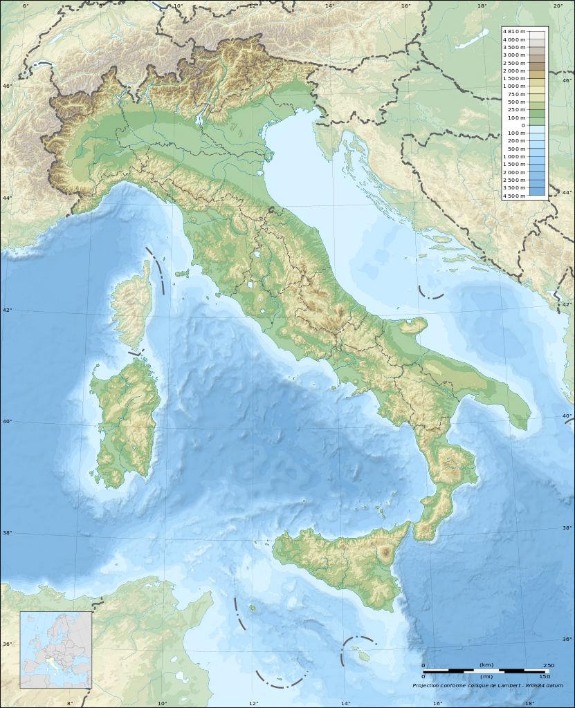
Jolanda di Savoia is a comune (municipality) in the Province of Ferrara in the Italian region Emilia-Romagna, located about 70 km northeast of Bologna and about 30 km east of Ferrara. As of 31 December 2004, it had a population of 3,298 and an area of 108.1 km². It is where the lowest elevation poitn of Italy is located which is: Le Contane, (-3.44m) at 44°53′N 11°59′E / 44.883°N 11.983°E as its mentioned in Italy elevation map.